Posts

Showing posts with the label Geology

مهندس جيولوجي خبرة

Image
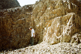
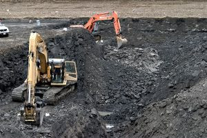
مهندس جيولوجي خبرة يطلب عمل! جيولوجي عبدالرحمن سليم عبدالرحمن مهندس جيولوجي استشاري خبرة بعمليات الحفر والجسات وكتابة التقارير الفنية خبرة في الأعمال الحقلية والمعملية وادارة المختبرات الهندسة وادارة الحفارات خبرة في الاشراف علي تنفيذ أعمال الخواذيق الهندسية قادر علي تنفيذ حفر الآبار وتسجيلات الآبار سواء مياه او بترول أو ابار الطاقة الحرارية خبرة في الإشراف علي تنفيذ ابار المياه وادراة عمليات الحفر والإستكشاف الجيولوجية والجيوتقنية والجيوفزيائية خبرة في الإستشارات الهندسية واعمال الردم والقياسات المساحية القدرة علي عمل ودراسة وكتابة تقارير لدراسات جيولوجية أو هيدروجيولوجية أو جيوبيئية أو جيوهندسية أو جيوتقنية لمشروع طرق أو كبارى أو انشاءات أو سدود أو مخرات سيول إلخ... وأقوم أيضاً بإدارة متجري الخاص في مصر ومتجري الالكتروني الخاص والاشرف علي عمليات التجارة الإلكترونية لسنوات عديدة ، ولدي مهارات في المبيعات والتسويق والتسويق الرقمي والإدارة وعلي معرفة جيدة بخدمة العملاء. مما سيفيدك كصاحب عمل في التسويق واجتماعات ابرام العقود لشركتك او مكتبك الاستشاري او الفني او المختبر التابع لك.   ...

Hiring Engineering Geologist or Geologist

Image
  Hiring Engineering Geologist or Geologist Hiring... Geologist Contract For 5 to 6 months 2) Engineering Geologist or Geologist Job description - Experience: 10 year's. Acquired background experiences in Geology, Engineering Geology, Soil and Rock mechanics, and Geotechnical site investigation :- ( Preliminary Site Characterization (Description), Test Holes and Sampling, Laboratory Testing, Soil Classifications, and Report ). -Pier foundations -Expert level written and verbal communication skills ( languages English, Arabic, ..etc) - Must be an Egyptian nationality and have a valid geologist license. - Job Location Madinaty, Cairo, Egypt.   If interested send your CV via massage union4tech @ outlook.com https://wa.me/201000686816 Egypt

Gold Mining in Egypt

Image
Gold Mining in Egypt Mining in Egypt is a not risky investment. last year mining companies tried to explore Egyption desert  or something happened?!

الاسباب الرئيسية لانهيار التعدين فى مصر

Image
خبير تعدين يطرح الاسباب الرئيسية لانهيار التعدين فى مصر. مشاكل التعدين واضحة وحلولها ايضا واضحة الفكرة فى اننا نريد الحل ام لا ؟!!!! هناك خمسة اسباب رئيسية اربعة ظواهر بالتبعية . اما الخمسة اسباب الرئيسية هى:- القوات المسلحة – المحليات – البترول – الشركات الوطنية– القوانين والتشريعات الاربعة ظواهر المترتبة على هذا الوضع هى :-

الجيوكمبيوتر

Image
الجيوكمبيوتر الجيوكمبيوتر كما اسميته او الحوسبة الجيولوجية وهي استخدام الكمبيوتر في مجال الجيولوجيا وتطويعه لخدمة علوم الأرض. ان استخدام الحاسوب في أي علم له مميزاته الكبيرة التي يطول الحديث عنها. سأتحدث عن

TED: Hunting for dinosaurs

Image
Hunting for dinosaurs

Geologic sample photo 2

Image
Here again we are drilling in Al-Namas , Saudi Arabia for geotechnical purpose and I am musing on samples for geologic purpose. Namas is a small town on the Arabian Shield . I still do not figure out the best catchy title for this blog series,

Geologic sample photo

Image
GSP #1 core sample in Afif, KSA. Geologic sample photo or "GSP" as abbreviation, it will be my new blog series which I'll publishing my photos of samples we're encountering by core drilling. I aim to start an open discussion about each samples

Granite ball

Image
While I was traveling on my way to work in the municipality of Al-Houmiyat, located on Riyadh-Makkah road, I was stopped by the road of a rock like a ball. A scene of the kind that makes you pronounce "Wow" !! A large ball of rock rests on a few centimeters firmly. Al-Houmiyat

حقن تربة الردميات العشوائية - Grouting

Image
   حقن تربة الردميات العشوائية - Grouting   ها هي مشاريع الحقن بالاسمنت لتثبيت التربة ومعالجتها تلاحقنا مرة أخري... كانت الأرض عبارة عن وادي قديم من الحجر الجيري ثم تم ردم الوادي عشاوائياً لتستصلح الأرض للبناء عليها

معالجة تكهفات الحجر الجيري

Image
  معالجة تكهفات الحجر الجيري     كان الانسان ولايزال يمهد الارض ليستقر عليها ويبني عليها، فليس كل مكان علي الأرض يصلح للبناء عليه، وحيث وجدت الحاجة لذلك وجدت الحلول الجيوهندسية. مشاريع حقن ومعالجة مشاكل التربة بالطبع هي فرصة للتعلم واكتساب الخبرة، انه مشروع حقن تكهفات في الحجر الجيري المحتوي علي حفريات أكثرها من الشعاب المرجانية. حيث سيكون المبني الذي سيبني علي تلك الأرض مقاوم للزلازل. جري العمل لتتبع الكهوف بطريقة كل تكهف أو فراغ يكتشف أثناء الحفر الدوراني لجس التربه، نقوم بعمل دائرة قطرها متر ومركزها الجسه التي تم إكتشاف التكهف والفجوات بها، حيث إستطعنا حفر 216 جسة  بإ جمالي طولي 1300 متر، وتم حقن 33.8 طن أسمنت لسد الكهوف، واستطعت إنهائه في 24 يوم. معالجة تكهفات الحجر الجيري ذو الشعاب المرجانية تم حساب الوقت المستغرق في الحفر كل 20 سم وكان يتم التأكد من سرعة هبوط خط الحفر لإستكشاف الفجوات. كان هذا المشروع مبعداً لي عن الكتابة والحياة الاجتماعية أو حتي التواصل عبر مواقع التواصل الإجتماعي، فضلاً عن إنني أعمل في غير موطني. ولكني أؤمن بإن ال...

Mountains in Qelwa District

Image
Qelwa District one of the main districts in Al Bahah , KSA. Shada Mountains Nature in Qelwa Mekhwah Sun behnin clouds Nature 2

Fun moment from geology trip (Accretionary Wedge #50)

Image
Evelyn hosting this month’s Accretionary Wedge geoblog carnival asking for fun moment from geology trip. It was a funny moment when the professor of geology leading the field trip wanted us to feel how Bahariya Oasis is deep below the see level. Bahariya Oasis a depression in Egypt. It is approximately 370 km away from Cairo.

Mega Geoscience News: Curiosity landing on Mars MGN #1

Image
Mega Geoscience New is my new blog series to catch up with the big news in geoscience, and keep up to date with achievement in my beloved science. 1 -  8 days till Curiosity Rover landing on Mars. The Science of Curiosity: Seeking Signs of Past Mars Habitability, Unlike previous

Programming language in geology/geophysics

Image
Programming language is an artificial language that is used to write programs in order to control the behavior of a computer.

عيوب تخطيط تدريس الجيولوجيا في مصر

قسم العلماء العلوم الطبيعية إلي ثمانية فروع رئيسية هي الكمياء، والفيزياء، والفلك، وعلوم الأرض (الجيولوجيا)، والأحياء، وعلم الجو، وعلم دراسة المحيطات والبحار، وعلم المادة، وبينهما علوم مشتركة ويتفرع منها علوم دقيقة. أي أن الجيولوجيا أو علم الأرض أحد الفروع الرئيسية للعلوم الطبيعية. في مصر بلغ القصور أن تدرس الجيولوجيا للقسم الأدبي في المرحلة الثانوية الذي يؤهل لكليات اللغة العربية والدراسات الإنسانية والأدبية ولا تدرس للقسم العلمي الذي يؤهل لدراسة الجيولوجيا في كليات العلوم! حيث المرحلة الثانوية في مصر هي المؤهلة للدراسات الجامعية. ومما زاد الطين بلة أن الطلبة الذين درسوا الجيولوجيا بالقسم الأدبي لا يستطيعون أن يلتحقوا بكلية العلوم ليدرسوا علم الجيولوجيا! وبلغ قصر النظر التخطيطي بواضعي المناهج الذي يظهر وكأنه خيانة واضحة للوطن والشعب، بأن يجعلوها مادة إختيارية لطلبة القسم الأدبي وبالطبع لا يختارها إلا قليل القليل من طلبة الأدبيات الذين لن يستفيدوا شيئاً من دراستها عند إلتحاقهم بالجامعة. قصر النظر التخطيطي جعل الشعب يجهل كيفية إستخراج ثرواته من باطن أرضه مثل البترول والغاز وا...

Accretionary Wedge #42: Rocky Eggs

Image
This month AW #42 named "Countertop Geology" by Ian Saginor of the blog  Volcanoclast. Have you seen a great countertop out there?

Hard dolomite cracked a drilling bit!

Image
Our funny crew showing broken carbide bit after a troubles while drilling in a hard dolomite in North Sinai, Egypt in a mission to reach the Nubian aquifer. http://youtu.be/KhTy0UoVa40 Drilling on earth have a lot of problem, I wonder what kind of machines and equipment we need to drill on the Mars in case of exploring for groundwater? :) http://youtu.be/6sk5IuIjr1E

Accretionary Wedge #38: Back to School

In response of Anne Jefferson questions for Accretionary Wedge #38 : If you are a current or future student… what do you want to know about life and careers in the geosciences? Are there things you aren’t getting to learn or do in classes that you think are important? What sort of experiences do you want to get out of school and how do you think school can or should help you prepare for a career? My respond here focus on, the method of studying geology. It's helpful to study how particular branch of geoscience are developed, like how continental drift theory are become the most accepted theory, but it's not necessary to study how seismic investigation are developed thorough the time. Students need to know how to interpret a seismic section; not to know who developed that branch of science so the large introductions of any subject in collage is like wasting the time. How is this branch of science work? why it useful? and how can i use it? that what i think is  important in stud...

The White Desert, Accretionary Wedge #37

Image
Mushrooms Image via Wikipedia The White Desert is located at the northern region of the Farafra Oasis . I had visited it within field trip to western desert. The white desert has been classified by government of Egypt as a natural protected zone in 2002 and covers an area of 3010 square kilometers. It's far 570 km from Cairo. The White desert is a unique geological phenomenon; where wind and water erosion sculptured their way through the soft chalk forming incredible shapes "Mushrooms". Along the road Baharia - Farafra, the main geological observations as many isolated hills and hillocks consisting almost of massive bedded, snow white chalk of Maastrichtian Khoman Formation. There are many fascinating geomorphologic feature accompanied the carbonate rocks of the plateau surface such as cave deposits and onyx,