Posts

Showing posts with the label Geology of Egypt

Hiring Engineering Geologist or Geologist

Image
  Hiring Engineering Geologist or Geologist Hiring... Geologist Contract For 5 to 6 months 2) Engineering Geologist or Geologist Job description - Experience: 10 year's. Acquired background experiences in Geology, Engineering Geology, Soil and Rock mechanics, and Geotechnical site investigation :- ( Preliminary Site Characterization (Description), Test Holes and Sampling, Laboratory Testing, Soil Classifications, and Report ). -Pier foundations -Expert level written and verbal communication skills ( languages English, Arabic, ..etc) - Must be an Egyptian nationality and have a valid geologist license. - Job Location Madinaty, Cairo, Egypt.   If interested send your CV via massage union4tech @ outlook.com https://wa.me/201000686816 Egypt
Gold Mining in Egypt

Image
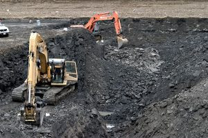
Gold Mining in Egypt Mining in Egypt is a not risky investment. last year mining companies tried to explore Egyption desert  or something happened?!

الاسباب الرئيسية لانهيار التعدين فى مصر

Image
خبير تعدين يطرح الاسباب الرئيسية لانهيار التعدين فى مصر. مشاكل التعدين واضحة وحلولها ايضا واضحة الفكرة فى اننا نريد الحل ام لا ؟!!!! هناك خمسة اسباب رئيسية اربعة ظواهر بالتبعية . اما الخمسة اسباب الرئيسية هى:- القوات المسلحة – المحليات – البترول – الشركات الوطنية– القوانين والتشريعات الاربعة ظواهر المترتبة على هذا الوضع هى :-

Fun moment from geology trip (Accretionary Wedge #50)

Image
Evelyn hosting this month’s Accretionary Wedge geoblog carnival asking for fun moment from geology trip. It was a funny moment when the professor of geology leading the field trip wanted us to feel how Bahariya Oasis is deep below the see level. Bahariya Oasis a depression in Egypt. It is approximately 370 km away from Cairo.

The White Desert, Accretionary Wedge #37

Image
Mushrooms Image via Wikipedia The White Desert is located at the northern region of the Farafra Oasis . I had visited it within field trip to western desert. The white desert has been classified by government of Egypt as a natural protected zone in 2002 and covers an area of 3010 square kilometers. It's far 570 km from Cairo. The White desert is a unique geological phenomenon; where wind and water erosion sculptured their way through the soft chalk forming incredible shapes "Mushrooms". Along the road Baharia - Farafra, the main geological observations as many isolated hills and hillocks consisting almost of massive bedded, snow white chalk of Maastrichtian Khoman Formation. There are many fascinating geomorphologic feature accompanied the carbonate rocks of the plateau surface such as cave deposits and onyx,

Location of Lost Circulation Zone Dilemma

Image
Lost Circulation is one of the major drilling problem geologists and drilling engineer’s struggling it while drilling a well for both oil/gas and groundwater. If a very porous, cavernous or highly fractured zone is encountered while drilling; an excessive amount of drilling mud is lost to that zone during lost circulation. The zone is called a thief or lost circulation zone. In this case I’ll explain dilemma I faced while drilling groundwater well in North Sinai, Egypt we expecting the aquifer at 1200m. Within drilling community North Sinai distinguishing by repetitive Lost Circulation. I joking with my colleagues we need to invent (Lost Circulation Preventer) instead of (Plow out Preventer). That lead me to design Excell worksheet to make cement job calculation easy work , because I think every repetitive work should has a system to make it done. The following table is the important data about lost circulation zones: Depth(m) Lithology/comment From to 372 404 Dolomite, ...

Sannur Caves in BeniSuef

Image
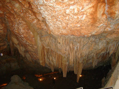
stalactites Sannur Cave is characterized by the presence of geological formations known as Stalactites and Stalagmites in a perfect beautiful formed over millions of years, about 60 million years ago dates back to the Era of Middle Eocene. Leakage of aqueous solutions of calcium carbonate saturated through the roof of the cave and then evaporated, leaving the mineral salts that accumulated in the form of deposits of stalactites and stalgmites. Sannur cave extends a distance of about 700 m, breadth about 15 m and depth is about 15 m. It’s Located in Beni Suef province, Egypt. about 70 kilometres southeast of the city. The cave is important to the scarcity of such natural formations “Egyptian Alabaster” as it is of great importance for researchers, Geologists, and Caving fans. Location: كهف وادي سنور في بني سويف من أجمل الكهوف التي رأيتها في حياتي. ما تراه في الصور هي أحجار جيرية نتجت عن عمليات التبخر من مياه الينابيع الحارة داخل الكهف، أو من عمليات ترسيب بطئ من قطرات ال...

Prototype General Stratigraphic of Egypt - A4

When i was in the academic year (4th year) I faced a problem that we have to memorize the name of the stratigraphic formation of Egypt in our minds to success and pass the exam in